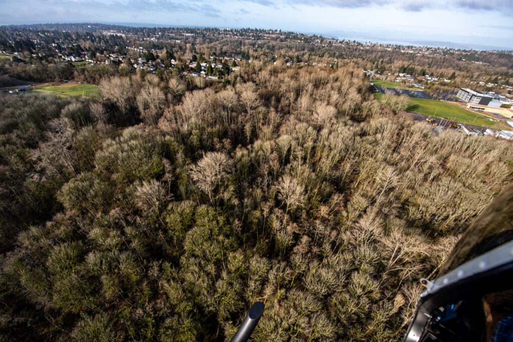
Armed with more than 200 white plastic bags, neon-clad neighbors gather at the West Seattle Greenbelt trailhead on a cold sunny morning in late February, 2021. Their mission is to make a trail visible from more than 500 feet above. At precisely 8:45 a.m., a helicopter will circle the greenbelt with Jean Sherrard’s camera peering out, photographing the bright white squares revealing the trail through the overhanging branches. Sherrard and Clay Eals are preparing a Now & Then column for The Seattle Times.

The bags are the brainchild of Paul West, member of the West Duwamish Greenbelt Trails group, who brings an ample supply from Puget-Ridge Co-housing. (They will be carefully collected and folded for re-use with only a few splotches of mud.) The volunteers start down the trail in small groups to drop their “bread crumbs” ten feet apart. As the temperature climbs above the mid-30’s, the white helicopter circles three times against a clear blue sky, above waving Hansels and Gretels (or is it a Christo team?).
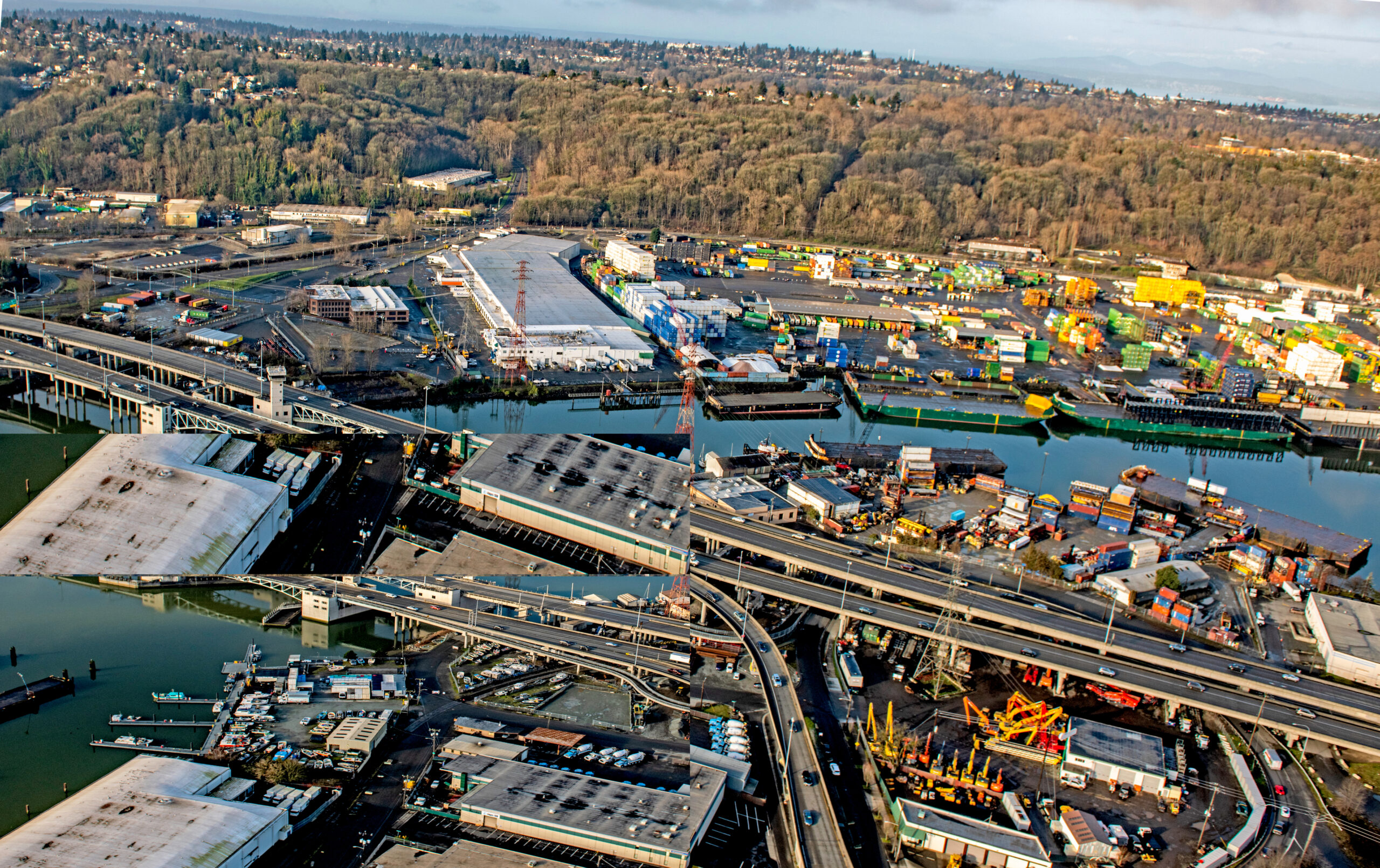
In the resulting aerials, the people are mostly invisible and the bag trail is faint, but the views of the ridge on the highlands between the Duwamish Waterway and Puget Sound are stunning. The green fields of South Seattle College and the Riverview playfields frame the greenbelt.

Industrial companies hug the river, colorful containers park at port terminals, the First Avenue South Bridge spans the river, and a belt of late-winter brown separates commerce from neighborhoods.

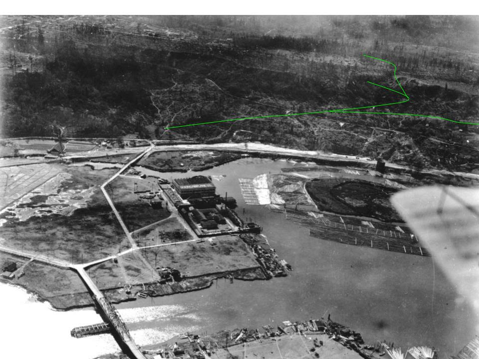
A 1920 aerial shows the same ridge, with fewer trees. Glacier action created the greenbelt ridge more than 60,000 years ago, leaving rocks resistant to erosion. A conifer forest of Douglas fir, western red cedar, and Sitka spruce grew on its slopes. The Duwamish people lived below it along the Duwamish River and its tributaries for centuries. As settlers and land developers moved in, the Duwamish were dispossessed, but the spirits (and bodies) of their ancestors live on in the soil and the trees.
Then Puget Mill Company extracted what they wanted from the ridge before donating 20 acres to the City of Seattle in 1912 for a park at the north end. The same photo shows Boeing Plant 1 sitting at the foot of Highland Park Way. The newly straightened and dredged river is visible below the tip of an airplane wing. A streetcar line, which ran from the tip of the Duwamish Peninsula south to new communities, shows faintly on the ridge. The green line indicates trails in the 2021 greenbelt.

This trail is included in the second edition of Hiking Washington’s History. A Now & Then column by Clay Eals and Jean Sherrard highlights the greenbelt in The Seattle Times, May 9, 2021. A more extensive description of this event and the trail is featured on their website.