A Missing Truth

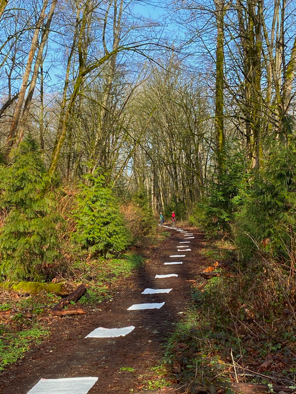
The Coal Mines Trail, which runs from Cle Elum through Roslyn and Ronald, Washington, reflects recent history in its name.  After logging, coal-mining was the reason for the towns east of the Cascade Mountains and southeast of Lake Cle Elum.  From the late 1880s well into the 20th century, immigrant miners from more than 20 European countries and Black workers brought in from the Midwest worked the rich veins of coal running under the foothills.  A memorial of miners who died working and the statue of a miner in front of what was the company store commemorate that history. 

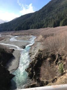
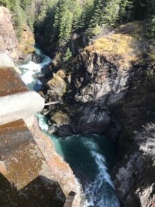
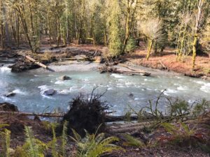
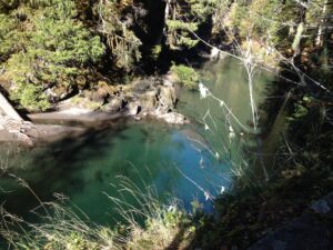
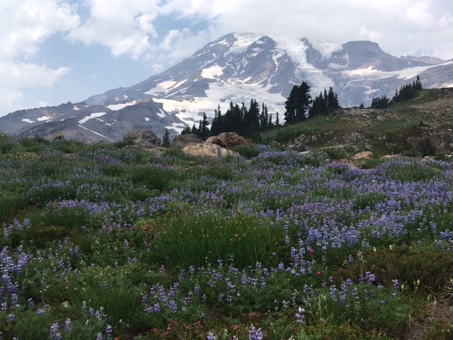
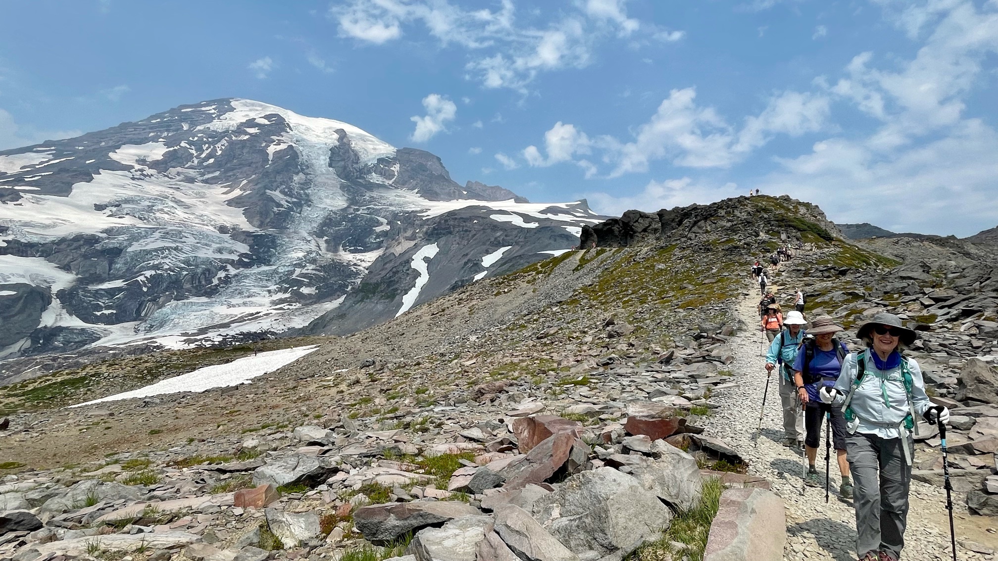
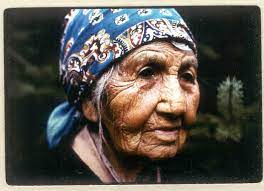
But coal mining is a short story compared to the centuries of use by native people. Yakama and Kittitas people have traveled through what is now Roslyn since time immemorial, heading for berry fields in the mountains and salmon fishing on Lake Cle Elum. The summer months of June and July drew large encampments at the south end of the lake, site of a village and large salmon trap.  Families camped all along the upper Cle Elum River from Salmon La Sac north to Fish Lake dispersing to gather berries at Paris Creek, Scatter Creek, and Goat Mountain, according to anthropological studies of the area. 

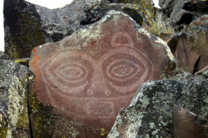
Those patterns were disrupted when the Northern Pacific Railway acquired land to not only build a transcontinental railroad but to mine for coal to power the trains.  Cheri Marusa, president of the Roslyn Downtown Association, calls native history “the missing truth.”  To acknowledge that truth, the Association and the Yakama Nation have funded a new sculpture in Pioneer Park, just feet off the Coal Mines Trail, on the edge of downtown Roslyn.  A large metal hand with glass insets in the fingers emerges from the ground on a traditional gathering place.

The sculpture, the Creator’s Law or Na’mi’ Tama’nwit, illustrates five key principles of the covenant the Creator made with the Yakama people:

                        Cherish the Earth

                        Cherish water

                        The Sacred Breath

                        Everything has a spirit

                        Connect with ancestors, past and future

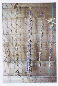
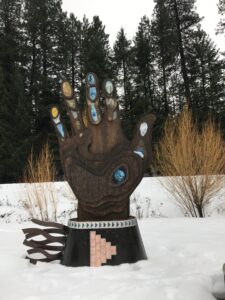
The hand rises 14 feet high from a wrist cuff foundation. Glass inserts on the thumb show clouds, Mt. Adams, and the earth from space, illustrating Cherish the Earth.   The index finger illustrates water, the giver of life, and each subsequent finger represents another principle.  An interpretive plaque at the site gives much more complete descriptions of the art.  Three concrete circle benches represent the Witnesses: the sun (A’an), the stars (Sha’ykw), and the moon (A’lxayx).

The sculpture was fashioned by Milo White, a metals artist, and Lin McJunkin, a glass artist.  They were aided in the interpretation of the principles by several Yakama Nation members, including Chairman Gerald Lewis and cultural consultant Noah Oliver.  George Selam, spiritual leader of the Yakama who spoke at the installation in October 2023, stated that the sculpture is an “interpretation of how the tribal members live on a daily basis, following the laws.”

The Creator’s Law acknowledges native heritage but also points a way forward. Estakio Beltran, representing Native Americans in Philanthropy, said “The indigenous knowledge that is contained in this monument has everything we need to chart a path forward.”  The goal is to honor continuing land and resource stewardship efforts in the area and to develop educational materials, public displays, and experiential learning opportunities.  See the Yakama Nation Footprints brochure on the association’s website for more information, including preservation of a camas field and fish passage facilities.  

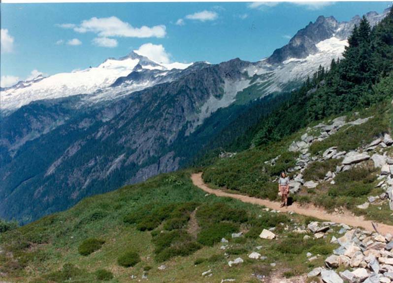
Trails, too, could be part of that stewardship.  Ancient trails led from Lake Kachess and Lake Cle Elum to fisheries and berry gathering areas on the upper Cle Elum River.  One primary route, used by leaders such as Ka-mi-akin, Ow-hi, Qual-chan and Quil-ten-enock, led along the river to huckleberry gathering near Salmon La Sac.  Large numbers of Indians gathered there at a spear fishing site. 

As late as the 1930’s, Indians came through Roslyn on the way to berry fields and fishing, according to Nick Henderson, a Roslyn historian.  They camped at Ducktown, a neighborhood in the south part of Roslyn, and soaked wagon wheels in the creek to tighten the spokes before heading over two ridges into Skookum Basin.  The old Skookum Road/trail led north from Roslyn over Cle Elum Ridge to the West Fork of the Teanaway River, along the West Fork to Yellow Hill, over Yellow Hill, hooking at the bottom into the Skookum trail at the Middle Fork Teanaway.  The trail/road then followed the Middle Fork Teanaway to Skookum Basin.

Today a seldom used and seldom maintained Skookum Basin Trail (1393.2) begins at the Middle Fork Teanaway trailhead (off Forest Road 4305-113) and ends along the Middle Fork/Jolly Creek divide at a high pass. Skookum Basin is likely near the source of the Middle Fork Teanaway below DeRoux and Koppen Mountains, according to Jim Kurseman who authors a website called Hiking Northwest

On several maps, “Indian Camp” is sited at the spot where the trail from Roslyn would have reached the Middle Fork Teanaway after crossing Yellow Hill.  It’s a plausible camping spot on the way to Skookum Basin. I always trust old names on old maps.


West Duwamish Greenbelt

A large greenbelt borders South Seattle College in West Seattle, separated from the back and east side of college buildings by a fence.  The greenbelt is little known to students, faculty, and staff who take for granted the view of Mt. Rainier to the south foregrounded by the thin forest. The grinding sounds of port industries along the Duwamish Waterway below compete with a few birdsongs.  Environmental Studies and Landscape Horticulture students use the greenbelt for field studies and fieldwork, but for some it was just a place to smoke.  

In fact, the West Duwamish Greenbelt is the largest contiguous forest in Seattle, 500 acres of evergreen and hardwood trees, native plants from currant to Indian plum, streams, a pond with at least two ducks in season, moles, birds, bugs, and butterflies. 

I taught Pacific Northwest History at South, which usually included a unit on Chief Seattle’s signing of the Treaty of Point Elliott–should he have signed?  Part of the assignment for this unit was to visit a Duwamish site.  The Duwamish Longhouse and Cultural Center and a village site on the Duwamish River sit below the college at the foot of the greenbelt, but getting there was always a challenge.  There was no connecting trail.

Since retiring from teaching, I have been active in the West Duwamish Greenbelt Trails group. The group advocates for reforestation and for the creation and maintenance of trails that would connect the college, schools, and neighborhoods at the top of  Puget Ridge through the greenbelt to the Longhouse. Forest steward and greenbelt activist Craig Rankin and I were interviewed by Keith Bacon on an AllWays West Seattle podcast. Check here for “Forging Connections in the West Duwamish Greenbelt” if this is an interest for you. The first part is a funny street interview introduction to the little-known greenbelt.

Glines Canyon Overlook

The Elwha River, which flows south to north through the interior of the Olympic Peninsula, has long been a popular attraction for backpackers.  

The lower Elwha River flowing freely

But when Craig Romano and I planned the second edition of Hiking Washington’s History, we had to omit one of my favorite trails along the river–to the lookout at Dodger Point.  There, during World War II, Leith and Mary Johnson watched for enemy planes that might be heading to Boeing or the shipyards of Puget Sound. They were on duty 24 hours a day, seven days a week, during the summer of 1943.

Fifty years later, after Leith died, Mary visited all seven lookout stations where she and Leith had served in the early 1940’s. At the age of 79, she carried a 25-pound backpack 14 miles and 5000 feet of elevation gain to Dodger Point.

Even more years later, Mary met me at the Whiskey Bend campground the night before my own hike to Dodger Point, sharing hot dogs and beans around a campfire and telling me stories of her years in the Olympics.  She and Leith were the human interest focus for the Dodger Point hike in the first edition of the guidebook. 

Now, the hike to Dodger Point is even more daunting.  The free-running Elwha River has washed out the road to Whiskey Bend and the campground, adding a 6.2 mile hike (instead of a drive) to the trailhead.  After years of advocacy for removal of two dams on the river and an act of Congress, the Glines and Elwha dams were removed from the river in 2012 and 2014, allowing salmon to return to spawning grounds they had not reached for a century since the dams were constructed to provide power in 1913 and 1927.  Soon the salmon returned, but the hikers did not return in force.

Washed-out road

Less than a year after the second dam was removed, November 2015 rains washed out 90 feet of the main access road to the Elwha River trailheads.  The National Park Service made a temporary repair and bridge, at a cost of $450,000, which opened in January 2017, then closed again in February.  November 2017 rains washed out the road again with water that peaked at 18,000 cubic feet per second, a surge that rose to the roadway and tore slabs of pavement away.

So we took Dodger Point out of the second edition, but we didn’t have the heart to take out another hike, the route of a Seattle newspaper-sponsored expedition into the heart of the Olympics in 1889.  We just noted that you have to hike more miles to get to the Whiskey Bend trailhead.  The men of the expedition spent two months getting to that point from Port Angeles and their whiskey was “pretty well exhausted.” 

This March I was curious to hike some of those miles to the trailhead, without whiskey and in one day, to see the changing course of the Elwha.  My husband Al and I walked the Olympic Hot Springs Road 3.4 miles not to Whiskey Bend but to the Glines Canyon overlook where the second dam on the Elwha was removed. 

The hike to the overlook is easy.  It begins at the trailhead for Madison Falls, where there is parking, an outhouse, and an attractive waterfall.  Walk around the gate on the road and begin walking in open country on pavement.  About one mile in is the washout and a bypass trail leading around the washout

Arrow points to Bypass Trail.

along the east side of the river.  After a sometimes slippery, sometimes muddy half-mile, you’re back on pavement with a view of the washout from the other end. 

From here the paved road leads through the Elwha Ranger Station, a series of locked, wooden frame buildings with an aura of lost vibrancy. Despite the usual government brown signs, the restrooms are closed, too; they are not easy to service without a road.  A dirt road cuts off to the left, marked to the Whiskey Bend trailhead, the jumping off point for both the Dodger Point and Press Expedition hikes.  I was wistful but not prepared for backpacking.  Instead, we continued toward the overlook.  After that turnoff, the paved road crosses the river on a bridge, a welcome amenity, winds past the closed Altair picnic area, and then climbs past a speed limit sign of 25 miles an hour and an unnecessary warning that RVs and trailers are not suitable from this point on.  Two cyclists careen down as we plod upward. 

At a bend in the road, a secure sidewalk leads to a stunning view deep into the canyon where a dam once stopped the Elwha River and backed it into Lake Mills, flooding approximately 438 acres of river and land.  To the north, the river rushes through the remnants of concrete walls on the sides of the canyon.  To the south of the overlook, the Elwha cuts a new course through the wide expanse of what was the lake bottom. 

The Elwha flowing through the bed of Lake Mills

 For an explanation of the revegetation work there, see National Park Service and Lower Elwha Klallam Tribe’s Revegetation and Restoration Plan for Lake Mills and Lake Aldwell.  Again, the bathrooms are closed, but interpretive plaques explain what transpired here.  

The Elwha flowing through Glines Canyon

The road continues on another 4.4 miles to the Olympic Hot Springs, which feature 21 seeps from the ground, hence the name of the road.  But you have to walk or bike there, and the springs are “unmaintained.” We turned around. 

It felt strange to be walking down a road and not hear the sound of approaching cars but the constant swift current of a river.We encountered few others on this route—the couple biking down from the overlook, a family of three hiking the same direction as us, and an Americorps crew returning from revegetation work in the old Elwha campground, which was also washed out.   We stepped aside on the narrow bypass trail for the last guy in the group who carried a car battery in a sling on his hip; they had hoped, vainly it seemed, to use one of the vehicles trapped at the Elwha Ranger station for transporting plants.  They piled helmets, work tools, the battery and tired bodies into a van on the north end of the bypass trail.  

Vehicles trapped at Elwha Ranger Station by washed-out road

To make the road and trailheads into the northern Olympics more hiker-friendly again, the National Park Service is working on an alternate route for the road, away from the floodplain, avoiding another surge from the newly freed Elwha.  A 2019 Environmental Assessment report presented three options:  no action to repair the road, modifying the current road alignment to raise grade, or a reroute of one mile of the road outside the floodplain.  As of Spring 2023, the environmental compliance process was not complete.  So for now, it’s still a long hike to trailheads–not a drive–but a rewarding walk in itself.

The freed Elwha River


Willis/Grindstone Trail

The road to glacial blue Mowich Lake, gateway to the northwest slope of Mt. Rainier, is a long, dusty, wash-boarded slog by car in the summer.  It was not always so. Tourists of another century took the train from Tacoma to Wilkeson and embarked on the oldest constructed trail to the national park, the Grindstone Trail.  The unlovely name betrays the pleasures of the 20-mile trail through thick forest, along creeks, over ridges, past lakes, and onto the sub-alpine meadows and glacial flanks of the mountain.

First called the Willis Trail, the trail was mapped and engineered by Bailey Willis, a geologist at the beginning of an impressive career. Willis and George Otis Smith conducted extensive surveys of the Wilkeson-Carbonado-Fairfax coalfields in the early 1880s for the Northern Pacific Railway. His surveys of resources would promote land-buying and coal-mining in the river valleys, but Willis extended the trail to timberline.   With funding from the railroad, which wanted to encourage tourism, he hired crews with shovels, picks, mattocks, axes, crosscut saws, and probably blasting supplies, aided by horse and mule power.

Completed in 1883, the trail began in the small town of Wilkeson, a mining camp.  Climbers, tourists, and hikers could stay at the new Tacoma Hotel, designed for the Northern Pacific by Stanford White, take the train to Wilkeson and hire packhorses there for the ride onto the volcano. They crossed the Carbon River at what later became the town of Upper Fairfax, a mining and logging camp (now a ghost town). Then it followed Evans Creek for two miles and crossed the creek to reach the headwaters of Evans and Voight creeks. The trail continued up a wooded ridge north of the Mowich River, through meadows of wild onions, crossed Meadow Creek and reached camp at the south end of what Willis first called Crater Lake, now Mowich Lake. The adventurous continued on foot to Spray Park, Seattle Park, and—the daring—to glaciers on the flank of the mountain.

In this 1907 map, the Grindstone Trail is the dotted line that goes past Grindstone Camp and on to Crater Lake (Mowich Lake).

For the comfort of travelers, there were two “camps”:  Palace Camp, on the north bank of the Mowich River, just west of the park boundary, and Grindstone Camp, at the headwaters of Voight Creek, near the junction with the trail to Spray Park.  The camp and trail took their names from a grindstone placed there to sharpen construction tools. One of the camps may have been known earlier as Barktown because shelter for workers was constructed from bark.  Willis added four buildings to Grindstone Camp, which a Tacoma newspaper called “the lone lodge in the Wilderness.”

A corduroyed section of the old Grindstone Trail

The Northern Pacific was keen to promote Mt. Tacoma as a national park, to give up land there for more productive timber land elsewhere. At the railroad’s request, Willis led several excursions onto the mountain’s slopes during the 1880s and 1890s.  In 1883 he guided a European expedition with the German paleontologist Karl von Zittel to the Carbon, Mowich, and Puyallup glaciers. Von Zittel was duly impressed as was Senator George F. Edmunds of Vermont who made the trip the same year and said he would be “willing to go 500 miles again to see that scene.”

In 1896 Willis brought his 10-year-old daughter Hope along when he made one of the first ascents of Rainier.  He accompanied Smith and Israel C. Russell, a noted geologist, to explore and examine the glaciers and rocks of the mountain. They started along the Grindstone Trail but departed from it to ascend the Carbon Glacier.  They established a base camp above Mystic Lake where Hope stayed for the next five days, along with the cook and Professor Henry Landes, who was not feeling well, waiting while the others climbed to the summit. She spent the days gathering firewood and flowers, mending, and floating little boats carved by the cook, according to Aubrey Haines.  “It was most lonely at night with the others asleep out there,” she wrote.  “I think those last two days, when we thought they were lost, must have been rather terrible to me,” but as the mountain stood clear in the sunset, she heard “Father’s ‘oopee,’ loud and cheery, from the slopes above us, and in a few minutes, Father came swinging into camp ahead of the others.” 

Travelers on the Grindstone Trail, and reports from Smith, Russell, and Willis, revealed the mountain’s wonders and beauty to the curious and adventurous.  The scientific community pushed to designate Mt. Rainier as a national park.  At the annual meeting of the Geological Society of America in 1893, a committee was appointed to write a memorial to Congress. “Rainier is majestic in its isolation, reaching 6,000 to 8,000 feet above its neighbors,” Willis and others wrote in the petition.  “It is superb in its boldness, rising from one canyon 11,000 feet in 7 miles.  Not only is it the grandest mountain in this country, it is one of the grand mountains of the world.” 

The “memorialists” further represented that the region was being “seriously marred by careless camping parties” and warned that its valuable forests and rare animals were being injured and would certainly be destroyed unless the area was policed during the camping seasons. Declaring the mountain a national park “forever” would protect people in the Yakima, Cowlitz, Nisqually, Puyallup, and White River valleys from flooding and provide “for the pleasure and education of the nation.” 

The campaign was successful in 1899.  Willis Wall, the almost sheer black rock wall, visible from Seattle on a clear day, was named in Bailey Willis’s honor. The wall rises 4000 vertical feet above the Carbon Glacier.   Willis Glacier, named after he reached it in 1881, was renamed Mowich Glacier. 

Today, only 1 and ¼ miles of the original Grindstone Trail is intact, where the trail reaches Mowich Lake.   It serves as a shortcut to the lake, a more direct route than Mowich Road in this section.  The trail crosses the road three times and is marked twice with roadside signs.  Those wishing to hike it as an alternative to the dust will find the first access at a new culvert on the left side of the road about three miles past the Mowich entrance to the park, just before a hairpin turn in the road. Look for a small square orange marker nailed to a tree.  The other two accesses are marked by signs where the trail crosses the road, but these may be covered with snow in the winter.  Snowshoers should look for markers on trees if there are no snowshoe prints to follow.

Some of the rest of the trail was obliterated or obscured by construction of the Mowich Road when it was blasted through rock in the 1930s, but much of the original eight miles of the Grindstone Trail within the national park remains, unmapped and unmaintained.  Volunteers are working to restore more of the tread that would connect the trail from the park’s boundary to the three sections near Mowich Lake. 

Hikers on the current trail to Spray Park are also following about 2.9 miles of the original Grindstone Trail.  With its fields of mid-summer wildflowers, the park is a premier destination. The crew building the trail in 1883 likely named Spray Park after the falls in the creek that broke “into a mass of spray.”

Willis’s career was only beginning at Mt. Rainier.  When the Northern Pacific went bankrupt in 1884, Willis worked for the United States Geological Survey, continuing his work of mapping and exploring volcanic geology.  He went on to study the geology of the Mt. Stuart area, to map the Snoqualmie quadrangle, ascend Gold Creek, and climb Denny Mountain and Silver Peak.  In 1900 he visited the Lake Chelan area, then Cascade Pass and Sahale Peak.  Eventually he became an international expert on earthquakes and a professor first at Johns Hopkins University and then at Stanford University. 

The son of a poet, Willis lovingly described the mountain that was first in his heart: “I have seen the glories of Switzerland, the grandeur of the Andes, and the grace of the beautiful cone of Fujiyama, but among the most renowned scenery of the world, I know of nothing more majestic or more inspiring than the grandeur of my own old camping ground, Mount Rainier” (The Mountaineer, 1915)

The ghost of Bailey Willis on a tree along the trail? 


The Beverly Bridge

One August afternoon while hiking the Snoqualmie Valley Trail west of North Bend, I encountered a weathered older man reclining on the grass beside his dog and cart.   He and the dog, he said, had pulled the cart all the way to Ellensburg on trails that cross the vast state of Washington.  One summer soon, he said, he would reach Montana.

Palouse to Cascades trail at Beverly

I believed him.  You can do that on the Palouse to Cascades trail that stretches 289 miles from the Snoqualmie Valley to the Idaho border.  I’ve hiked many miles of the trail, on the forested grade leading up to Snoqualmie Pass and in the dry, endless miles east of the Columbia River.

But there has been one huge gap in the trail—crossing the river itself. 

The Chicago, Milwaukee, St. Paul, and Pacific Railway (known as the Milwaukee Road) crossed the Columbia on a bridge built in 1909, seven miles south of Vantage where I-90 crosses the river today. Railroad workers bunked in the community of Beverly on the east side of the river, so the bridge was called the Beverly Bridge.  

The Milwaukee Road was the last transcontinental railroad to reach Puget Sound, by way of Cedar Falls to Tacoma, with a spur to North Bend.  Unlike the Great Northern and the Northern Pacific, the Milwaukee was powered by electricity, so there was no need for a company town like Roslyn to provide coal and the dangerous work of mining. Overhead wires known as catenary carried electricity from twenty-two substations.

Ultimately the electric road was too expensive. The last train crossed the Beverly Bridge in 1949. In 1980 the Milwaukee Road stopped operating; the rails were pulled, and the state took over the right-of-way.  Then the political struggle began.  Some wanted to preserve parts of the trail for possible railroad use; recreationists wanted a cross-state trail for horseback riding, biking, and hiking.  Ultimately, approval for a cross-state trail depended on compromise.  One legislator promised his vote if the proposed trail was named the John Wayne Pioneer trail. So it became the John Wayne Trail in eastern Washington and the Iron Horse Trail in western Washington (recently renamed the Palouse to Cascades trail).  A few sections would remain in private hands, operating as a short-line railroad. 

The trail opened but not the bridge over the Columbia River. Trail travelers had to detour north to the I-90 crossing of the river, a highway with no shoulder and no pedestrian lane.  The bridge was placed on the National Register of Historic Places, but that didn’t pay for its restoration.  Decking on the west end was damaged by wildfire in 2014.  In 2017, the Washington Trust for Historic Preservation put the bridge on its most endangered list.  The closed bridge also came to national attention through the Rails to Trails organization and a proposed Great American Rail Trail from Washington, D.C. to Washington State. 

The main obstacle was expense.  The bridge would cost $5.5 million to restore, with added railings and decks.  More compromises were made—in return for allowing the Burlington, Northern Santa Fe to remove three historic rail bridges elsewhere in Washington, the Beverly Bridge would be saved.  The Washington State legislature approved a funding package. 

Retrofitting began but at the cost of human life.  In August 2021, Gabriel Zelaya, 39 years old, was laying curing blankets on the new bridge deck.  Guardrails had been removed from the bridge; there was a catenary line on one side to which workers could attach a harness, but the line had a gap, and no one, worker or supervisor, was wearing fall protection.  Zelaya fell 60 feet to an island below the trestle and died before he could be airlifted to a hospital.

His death was remembered and honored in April 2022, when the restored bridge was re-opened, to the accompaniment of the Wahluke High School band from Mattawa by civic leaders.  Governor Jay Inslee had planned to bike across the bridge and state senator Judy Warnick planned to cross on horseback, but the wind coming through the Sentinel Gap, between the Saddle Mountains on both sides of the river, was too strong.  Dignitaries held fiercely to their notes, except for Johnny, Clayton, and Lela Buck, elders of the Wanapum who have lived on the river since time immemorial. They spoke freely without notes.  One especially tall participant—Fred Wert of the Palouse to Cascades Coalition—minimized himself as a windbreak by sitting down to read.

The word began to spread around the hiking and historic preservation community—the Beverly Bridge was open.  On a trip to Spokane via Palouse, my husband and I stopped for a hike.  As Highway 24 passes under the eastern approach to the bridge, words on the bridge itself announce the Palouse to Cascades trail, but there are no brown state parks signs leading to trailheads.  We found a few parking spots in Beverly, which is a small community of mainly mobile homes.  The approach on the west side comes via the Huntzinger Road heading south from Vantage. 

Despite the wind (always present), the one and a half-mile walk across the bridge and back is a thrill. What the Wanapum call the Big River flows north and south under the bridge and the views from seven benches spaced along the decking are expansive; the solitude and quiet are restorative. We encountered two families walking the bridge, one runner, two guys with Maga hats, and two bicyclists coming from Wanapum State Park.

The original trestle is a work of art proudly remembered by a great-grand-daughter of H[erman] B. Earling, the superintendent responsible for all of the lines of the Milwaukee Road from eastern Montana to Seattle.  The Earling descendant (who did not give her own name) spoke near the end of the dedication when spectators were invited to comment.  She said the bridge was considered one of the wonders of the world at the time it was built.

It still is, and so is the Big River. 


Desmond Tutu

In the decades when Nelson Mandela was in prison, Desmond Tutu was the voice of the anti-apartheid struggle in South Africa, a voice motivated by Christian values. 

“You brought us the Bible and we are taking it seriously,” Tutu explained.  He did not separate religion from politics but preached a non-violent activism that challenged the white supremacy he labeled un-Christian. 

Tutu was educated in Anglican schools and influenced by Father Trevor Huddleston, who came from a wealthy family in England to serve the neighborhood of Sophiatown in Johannesburg.  Unable to pursue either a medical career, because of the cost, or a teaching career, because he refused to teach under restrictions the government placed on schools for blacks, Tutu became an Anglican priest instead.  Rising through the ranks to become a bishop and then general secretary of the South African Council of Churches, Tutu then became the Archbishop of Capetown in 1986, the first black person to hold that post as leader of the Anglican church in South Africa.

In his role as a spiritual leader at a time when political leaders of the anti-apartheid movement were all in exile, in jail, or dead, Tutu constantly denounced apartheid, but he preached non-violence.  He once stepped into a mob to rescue a man suspected of being an informant.  He had the rare ability to talk to both blacks and whites.  To whites he said that a belief in racial superiority was un-Christian.  To blacks he said that the enemy was white supremacy, not white people.  Christianity promised freedom, he said, and God was on the side of the oppressed. Tutu’s message was easier for whites to hear than the more revolutionary voices, but his voice demanded action, too, allying in a search for justice. 

He also had a sense of humor which he used to chide the powers that be.  When some whites saw him as an ogre because of his political activism, he responded, “I manage with consummate skill to hide my horns, under my funny bishop’s hat, and my tail tucked away under my trailing cape.”

His Christian activism inspired me when I wrote a young adult biography of Tutu in 1988, two years before Mandela was released from prison.   In an international phone conversation, more difficult in the days before cellphones, the Archbishop invited me to South Africa to interview him, but his government would not issue a visa.  Clearly considering Tutu a troublemaker, they responded that he comes to “your country” often enough.  (When Tutu traveled to churches around the world urging economic pressure to provoke non-violent change in South Africa,the government routinely withheld his passport.)  So I enlisted the help of a South African journalist to interview him and send me a tape, and I interviewed his daughter, who was living in the United States.  Only later, in 1987, did I meet him in person when he gave the commencement address at Oberlin College, the same year as my 20th reunion. 

His message was the same:  peace would come through the efforts of “black and white together.”  He preached justice, peace, and reconciliation, in that order.  When Mandela was freed in 1990, Tutu could go back to being just a bishop.  When Mandela was then elected as the first black president of South Africa, he chose Tutu to lead a process of reconciliation.

Reconciliation is still in process.  The evolution of a more democratic structure in black-majority South Africa has not been smooth, but Tutu’s legacy of dialogue between whites and blacks, at a time of violence by the white government and violent resistance, established the framework for a path forward. 

Resonance

Duwamish tribal member James Rasmussen stood six-feet tall in front of my Pacific Northwest History classes at South Seattle College to talk about the history of the Duwamish peninsula, the place we know as West Seattle.  He would begin by proudly introducing himself as the son of …, the grandson of…, the great-grandson of …; the great-great grandson of Quio-litza; the great-great-great grandson of Tupt-Aleut and Kruss Kanum–tracing his native line back some 200 years.  Giving the names of his elders told knowledgeable listeners what kind of a person he is. I envy that heritage–that he lives on the same land his ancestors lived on for centuries.  

As an emigrant to Washington 40 years ago, from Indiana by way of Ohio and New York City, I am among those Americans the Native people describe as restless. I moved away from a homeland that felt confining, especially for women. Like most Scotch-Irish, the McBrides were not landowners until very recent generations.  We do not stay put.  We must search for resonance—a sense of ourselves in history–in new places.  In the United States, we are among the “westering.” 

In the book Winter Brothers, beloved Northwest writer Ivan Doig drew a brotherly connection between himself and James Swan, who lived on the Pacific Northwest coast more than a century before Doig.  Swan was a mid-1800s jack of all trades around Puget Sound:  census taker, customs agent, schoolteacher, Indian agent, amateur anthropologist, and general hanger-on among the Makah and other coastal tribes.  He was also a writer who journaled events of his daily life for years.  Reading those diaries, Doig found himself “in a community of time as well as of people.”  He records watching gulls sail across his line of sight much as Swan saw them a century before him.

“Resonance of this rare sort,” Doig wrote, “we had better learn to prize like breath.”

 Ozette Memorial

Another beloved writer, Ruth Kirk, found resonance as she researched and wrote a book on the mudslide at Ozette that buried a Makah coastal village.  In work at the archaeological dig, Kirk fingered a piece of basket woven by a woman hundreds of years before her:  resonance.

So as I researched and wrote Hiking Washington’s History I searched for resonance on trails, for places where I fit in the community of time and people of Washington.

Finding the contemporary community of people was not hard. Generations of hiker-writers have made trails accessible to newcomers. Louise Marshall started the newsletter that has become the Washington Trails Association’s magazine.  She wrote the first local trail guidebook with Harvey Manning and Ira Spring.  Jack Nisbet found an historic brother in David Thompson who mapped the 1250-mile length of the Columbia River in 1811.  Ruth Ittner introduced me to the Iron Goat Trail.  Chuck and Suzanne Hornbuckle led explorations of the Oregon Trail in Washington.  Trail advocates Ray and Susan Paolella and Rick McClure, anthropologist for the Gifford Pinchot National Forest, introduced me to the Yakama-Cowlitz Trail. 

The community of attentive hikers in Washington is large, but finding the community of people from centuries ago was the surprise. 

Looking for historic trails to explore and write about in the state, I found an x on a map of the Wenaha-Tucannon Wilderness labeled Indian Corral, so I followed Chief Joseph’s summer trail into the Blue Mountains, to high tableland with only elk and fox for company.  I understood why the Nez Perce did not want to leave this land abundant with springs, camas and grazing for horses, stretching for miles into the horizon of mountains.

    Tsagigla’lal, She Who Watches,                        photograph by Angie Moore

Standing beneath a sun-shaded petroglyph overlooking the Columbia River, I looked into the face of Tsagigla’lal, She Who Watches.  Of course she would watch this river to protect her people from intruders.  She still watches.

Seeing young boys dive into the clear, deep water of the Blue Hole at the confluence of the Ohanepecosh River and the Clear Fork of the Cowlitz River, I just knew that people had gathered here for centuries to camp, to fish, to dive into the water.  Indeed it is still a campground today, La Wis Wis, in the Gifford Pinchot National Forest.

   The Blue Hole

Reaching the summit of Cowlitz Pass, with trails leading through meadows and around ponds in all directions, I sensed this was a crossroads, a place where at any moment someone might come around a bend on foot or on horseback.  Well-worn campsites along the lakes mark this as a good place to spend summer months, drying huckleberries, hunting elk, among people gathering in the shadow of Mt. Rainier. 

  Cowlitz Pass

There were more places where I experienced the same wonder felt by early travelers and explorers:  the blue-green Goblin Gates in the Elwha Valley where Charles Barnes of the Press Expedition imagined a goblin grotto; Yakima Pass where George McClellan felt with his feet that “we had crossed the divide”; finding kinnickinick where the Press Expedition found it, too, in the Olympic Mountains; smelling wild onions on the Umatilla Reservation; hearing the South Fork Stillaguamish River roar over rocks through the Old Robe canyon, a force that frequently washed out the railroad tracks along the side. 

But despite these shared experiences, this sometimes felt like a borrowed resonance–not my people, not my place.  

I’m from a part of the North American continent with farmhouses surrounded by corn fields and cherry trees.  My people came from a different continent, many generations ago. How many generations must one family remain in one place–one county–to feel the same grounding Rasmussen feels?  If I went to Ireland and Scotland and Germany and England, would I feel that connection to an ancestral land?  I doubt I would find it there, but I might find it in Indiana where I spent most of the first 18 years of my life. 

At the same time I was working on Hiking Washington’s History, I was gathering letters my parents had written to each during World War II and fashioning them into a narrative of their young lives in southern Indiana.  Both the Hart and McBride families had lived in a few counties there—Daviess and Vigo–originally in a place called “Possum Holler” (Hollow)–for several generations.  If I had stayed in Indiana, instead of leaving for college and moving on from there, would I feel resonance in Indiana farmland?  Wringing a chicken’s neck like my grandmother did? Canning tomatoes?  Unlikely—I spent half of those 18 years in a city, Indianapolis–but I retained the action of snipping the ends off of green beans and rolling out dough for homemade noodles.   Both of my grandmothers made quilts—my Grandmother Hart’s unfinished from the 1930s, my Grandmother McBride’s completed in 1970 for my wedding.  Sleeping under that quilt is resonance.  I feel the soft fabric, recognize some the myriad scraps she fashioned into the wedding ring pattern.  I feel her hands, remember her face and her voice.  My daughter and grand-daughter have family-made quilts, too:  four generations—resonance like Ruth Kirk’s basket. 

As my family gathered for my mother’s funeral, in the back of the church I grew up in, an older woman looked at me and said, “You’re a McBride, aren’t you?” The warmth I felt from that recognition may be my equivalent of Rasmussen’s heritage of names


Instagram Trails

Photos by Juli Hills

On a weekday in early August—prime wildflower season in the mountains—I returned to an old favorite, the Skyline Trail at Mt. Rainier.   Along with several hundred other people.  Privilege gained me admission with a senior pass at the Longmire entrance.  Good luck found space for our car of four in the main parking lot at Paradise.  Although the Visitor Center was closed, the bathrooms and water fountains were working.  As hoped, the lupine, paintbrush, bistort, heather, false Hellebore, pasqueflower, monkey flower, phlox, and many others were in full bloom.  It was hot, and the sky was hazy—we did not see all the volcanoes from Panorama Point–but Mt. Rainier was close.  At 7000 feet, the chunk of ice I scooped from one unmelted snowfield cooled my head, chest, and wrists.   I enjoyed the young boy who told me the hike would be much more fun on the way down and the father who pulled his family to the side of the trail because “they’re climbing.” He, too, said the fun would begin at the top.

Despite these joys, the hike was not pleasant.  People frequently stepped off the rock-lined trail in ill-guided attempts to be polite and give way to other hikers.  A woman fed Cheetos to a chipmunk, to the amusement of her companions.  Another woman carried a chihuahua in her backpack (a chihuahua at Mt. Rainier?!).  Hikers tromped on meadows for an Instagram photo.  A procession of 15 to 20 people walked up the paved path from a tour bus. A young woman plopped herself down on a purple pad in a beautiful meadow of wildflowers next to a stream.  I do not envy the ranger I complained to.  Trails are too crowded; we are loving them to death, and good trail etiquette is rare. 

Media attention has focused on the overwhelming crowds at national parks this summer of 2021, even without foreign tourists.  Cooped up for months by virus and weather, people like me are thronging to the outdoors. Glacier, Yosemite, and Rocky Mountain now require ticketed entry. Hikers at Zion have waited four hours to access certain trails.  Arches is turning visitors away because the park is “full,” closing its entrance gate most days by 8 a.m.

If you hike for that iconic selfie with a dramatic skyline, the wait can be worth it.  If you hike for solitude, not so much.  For many, getting away to the outdoors means away from city noise or suburban irritations, away from commuting, from shopping, from robocalls, from scrolling Facebook.  Today, much of that distraction comes with us on the trails.  A hundred parked cars stretch down-road from popular trailheads on a weekend.  Gross blue doggie bags perch beside trail markers.  A fellow writer told me of a cartoon showing a person on a mountaintop with a laptop open, writing “I feel so connected.” 

 I remember hiking to the top of McClellan Butte, a nine-mile round-trip, 3700-foot elevation gain hike off I-90 west of Snoqualmie Pass in the 1990s.  It’s no easy stroll, and when I reached the narrow top, I had to share it with a guy on his cellphone, yakking away about his awesome hike, which made it much less than awesome for me. 

From another hike, I will never forget the image of a group of young people “mudding”—seeing how far they could dig a truck into and out of the mud in a meadow alongside the historic Naches trail northeast of Mt. Rainier.

According to the Wilderness Act of 1964, wilderness is an area “where the earth and its community of life are untrammeled by man.”  Fat chance.   

Alan Weltzien addressed this issue in Exceptional Mountains, University of Nebraska Press, 2016. He considered the tension between access and preservation, the difficulty of finding solitude in a steady stream of hikers or climbers.  Weltzien argues that the “endless freedom of high country close by reconciles many to urban life,” but if urbanites crowd the mountains, that endless freedom is lost.  The proximity of Seattle and Tacoma and Bellingham and Vancouver and Portland to the exceptional mountains of the Cascades promotes “quick thick visitation” or a “windshield wilderness” experience. 

How can we maintain a balance between wanting solitude in nature and sharing the wilderness with others? If we value remoteness from the sights and sounds of people, if going places untrammeled by man or woman is a transformative experience, all should have that opportunity, but how can we get away from us all?  Maybe writers should stop writing hiking guides, everyone should stop sharing pictures.  We could lift up the wet gray Seattle image so tourists won’t want to come here.  Should we mention earthquakes, mudslides, volcanoes, and even drought?    All of those efforts might help, but the Northwest is steeped in the ethos of going to the mountains.  Whether it’s the macho climbers of the 1800s or the weekend backpacker/hiker who shares exploits with colleagues on Monday morning, getting to the mountains is one of the reasons we live here. 

This question bedevils many who hike and many whose job is managing the wilderness experience.  Forest managers have experimented with a system of advanced reservations balanced with first-come, first-serve permits on popular hiking routes.  A lottery system is already in place for the Enchantments in the Alpine Lakes Wilderness of Washington.  Climbing is rationed on Mt. St. Helens and Mt. Adams.  Shuttles carry hikers to popular trailheads like Dog Mountain on the Columbia River. Timed entry or ticketing systems for national parks are being considered.  

The logistics of restricted access can be daunting for the hiker.  A backpacking trip over Cascade Pass to Stehekin requires elaborate planning and a great deal of luck.   When four of us, two mothers and two daughters, hiked it a few summers ago, the success depended on securing backcountry camping permits for two nights at a hikable distance apart.  We left Seattle at 5 a.m. on a Sunday to arrive at the ranger station when it opened at 7 a.m. Second in line to a Boy Scout leader who had camped out the night before, we scored rare permits for Monday and Tuesday nights, 12 miles apart.  Our anxiety much reduced, we happily shared Pelton Basin with the Boy Scout troop Monday night.   Cascade Pass was completely fogged in and the spectacular views nonexistent, but we had to give up any pretense of hiking when the weather was optimal.

Besides planning and luck, what can an individual do?  Avoid popular trails and popular times of the week, savor the experience without technology other than good boots and a pack, but most of all practice environmental ethics, attentive to the environment and fellow hikers.  Here’s what I have learned from experience and from Leave No Trace principles. 

  • Downhill yields to uphill hikers who need to maintain momentum, but just stop and step aside, not off the trail.
  • A diet of Cheetos and dependence on human food does wild animals no good. They may lose the ability to gather food themselves. 
  • In subalpine climates, where the growing season is about two months long between snow melt and fresh snow, meadows are fragile. One footstep can destroy a decade of growth.  All those signs that say fragile meadow, stay off, or stay on the trail between the rocks, are the rules not of government but of nature.  Plant yourself on rocks instead. 
  • Barking, uncontrolled dogs are no one’s idea of enjoying the wilderness. See “5 Common Trail Dangers that Could Kill your Dog” and ways to avoid those dangers.  (I have encountered a grieving man carrying a dog that had died from a fall off the trail.) Dogs are not allowed on trails in national parks. 
  • Limit the size of your hiking group. At Paradise at Mt. Rainier, a wide paved trail leads from the parking lot toward the majestic mountain and views of the beautiful meadows, but large groups disturb wildlife and other hikers. 

The task of trail education is huge.  Are people uncaring or unknowing?  If unknowing, we have a huge education task.  If uncaring, we have a huge political task.  Wallace Stegner said our national parks are “America’s best idea.  They reflect us at our best rather than our worst.” Let’s keep it that way. 

Women on the Trails

The Trail: It is dusty; it is wet.  It climbs; it falls; it is beautiful and terrible.  But always it skirts the coast of adventure.  Always it goes on, and always it calls to those who follow it.  Tiny path that it is, worn by the feet of earth’s wanderers, it is the thread which has knit together the solid places of the earth.  The path of feet in the wilderness is the onward march of life itself, Mary Roberts Rinehart. 

As I started researching Hiking Washington’s History, I visualized historic trails through the mountains, along the rivers, and even through the dry Grand Coulee.  I saw men on these trails. 

In 1889 The Seattle Press called for “men of vim and vigor” to explore the unknown interior of the Olympic Mountains and report back to the newspaper.  Records of the Hudson’s Bay Company, the Northern Pacific and the Great Northern railways, the mining companies at Monte Cristo were all written by men and reported men’s doings—if you discount the occasional cost items for a laundress.   

When the first edition was published, I was seated at an authors’ table at a conference next to Karen Blair, history professor at Central Washington University, who asked me, “Are there any women in your book?”

My short, embarrassed answer: “Not many.” 

Fay Fuller was the first woman to climb Mt. Rainier.

A postcard image of Fay Fuller–the first woman to climb Mt. Rainier—sat on my desk the whole time I was writing the book, but I didn’t follow her to the summit or write about her climb.  I wrote instead about Forest Service ranger Hal Sylvester who named lakes in the Wenatchee-Snoqualmie National Forest for women—wives, sisters, sweethearts. 

I had fallen into the heroic nature-heroic men approach identified by Carlos Schwantes in his preface to the first edition of The Pacific Northwest, used as a textbook in college classes throughout the state. The theme of this approach is that “because nature assumed heroic proportions in the far Northwest, heroic men were needed to tame or subdue it.”  That tradition elevates the stories of men who “conquered” the wilderness and left their names on the trails in Hiking Washington’s History:  Stevens Pass for engineer John F. Stevens, Ebey’s Landing for pioneer Isaac Ebey, O’Neil Pass for Lt. P. O’Neill of the U.S. Army, Chief Joseph’s Summer Trail for the leader of the Nez Perce, the Mullan Road for army engineer John Mullan.

For the second edition I determined to include more women. I found Mary Roberts Rinehart.  Rinehart was an adventure tourist, not a trail builder; she merely left a compelling story of a woman’s trip through a little known mountain pass in the Pacific Northwest.

Today Cascade Pass is an iconic hike in Washington, a day hike that reaches spectacular views of towering mountain peaks in the North Cascades. The more adventurous can backpack all the way through to Stehekin at the head of Lake Chelan.  The hike just to the pass and back is doable for the average hiker—not quite four miles up, 33 switchbacks, 1800 feet of elevation gain on a well-maintained, easy to follow trail.


It was not so easy in early September, 1916when Cosmopolitan commissioned Rinehart to undertake and write about what she called “the first trip ever made on horseback over Cascade Pass.” The Great Northern Railway underwrote the expedition as part of its “See America First” campaign, hoping it would attract tourists to the Pacific Northwest.  

Mary Roberts Rinehart was a nationally famous writer, whose mysteries eventually earned her the title “the American Agatha Christie.”  She wasn’t a trail-blazer in the traditional Northwest sense of the word. She was following an ancient “way through.”  Native Americans had crossed Cascade Pass to reach “the Great Salt Lake” (the Pacific Ocean).  Native women had been trekking with their families into the mountains every summer for centuries, to gather berries, trade, and socialize.  

Mary Kiona often crossed Cowlitz Pass or White Pass on foot to visit her relatives on the east side of the Cascades.

It seemed to Rinehart that no one had been there before her expedition of 16 people, including her husband, three sons, cooks, guides, a timber cruiser, a photographer, packer, and 32 horses. The packhorses carried the cook’s sheet-iron stove; besides flapjacks, he served fresh grapefruit for breakfast each morning.  Despite this support and Rinehart’s adventurous spirit, the trip was daunting.

Mary Roberts Rinehart led a horseback expedition to Cascade Pass in 1916.

[N]ever had I dreamed of such a country; it was beautiful, but rugged and wild beyond belief.  There were abysses appalling to the mind, vast glaciers, towering peaks.

Camped below Cascade Pass, they found it was closed with ice and snow. But the horses were short of food, and they could not face going back the way they had come.  It was strange to go through that green wonderland and find not a leaf the horses could eat, Rinehart wrote.  It was all moss, ferns, and evergreens.

So on they went.  Crossing the pass mean climbing to a lake up “a tortuous cliff,” then scaling another 800 feet of mountain wall, without a visible trail.  

For the climb up that cliff the next day I have no words, and how they got down from the wall on the other side, I do not remember.  

My four trips to or across Cascade Pass have not been fraught with the same challenges Rinehart faced if you discount drizzle and fog twice shutting out the glorious views on top, in August.  The contemporary logistical challenge of backpacking is not finding food and water for horses but securing camping permits for the very popular trail.  Freeze-dried food can’t compete with a cook, fresh grapefruit, and someone else to set up the tents. Yet adventure and beauty still draw men and women alike, some no doubt lured by Rinehart’s vivid prose. 

Read more about Rinehart’s trip in my article in Columbia, the magazine of Northwest History, Summer 2021.  If you want to hear more from Rinehart herself, read Tenting To-Night, a book based on her travels in the Pacific Northwest.  It is available in print or online at gutenberg.org or Google books. 


West Duwamish Greenbelt trails

Armed with more than 200 white plastic bags, neon-clad neighbors gather at the West Seattle Greenbelt trailhead on a cold sunny morning in late February, 2021.  Their mission is to make a trail visible from more than 500 feet above.  At precisely 8:45 a.m., a helicopter will circle the greenbelt with Jean Sherrard’s camera peering out, photographing the bright white squares revealing the trail through the overhanging branches.    Sherrard and Clay Eals are preparing a Now & Then column for The Seattle Times.

The bags are the brainchild of Paul West, member of the West Duwamish Greenbelt Trails group, who brings an ample supply from Puget-Ridge Co-housing.   (They will be carefully collected and folded for re-use with only a few splotches of mud.)  The volunteers start down the trail in small groups to drop their “bread crumbs” ten feet apart.  As the temperature climbs above the mid-30’s, the white helicopter circles three times against a clear blue sky, above waving Hansels and Gretels (or is it a Christo team?).

In the resulting aerials, the people are mostly invisible and the bag trail is faint, but the views of the ridge on the highlands between the Duwamish Waterway and Puget Sound are stunning.  The green fields of South Seattle College and the Riverview playfields frame the greenbelt.

Dotted trail line is faintly visible through the greenbelt. Photo by Jean Sherrard.

 Industrial companies hug the river, colorful containers park at port terminals, the First Avenue South Bridge spans the river, and a belt of late-winter brown separates commerce from neighborhoods. 

Industrial uses crowd the Duwamish Waterway with the West Duwamish Greenbelt in the background. Photo by Jean Sherrard.

A 1920 aerial shows the same ridge, with fewer trees.  Glacier action created the greenbelt ridge more than 60,000 years ago, leaving rocks resistant to erosion.  A conifer forest of Douglas fir, western red cedar, and Sitka spruce grew on its slopes. The Duwamish people lived below it along the Duwamish River and its tributaries for centuries. As settlers and land developers moved in, the Duwamish were dispossessed, but the spirits (and bodies) of their ancestors live on in the soil and the trees.

Then Puget Mill Company extracted what they wanted from the ridge before donating 20 acres to the City of Seattle in 1912 for a park at the north end.  The same photo shows Boeing Plant 1 sitting at the foot of Highland Park Way.  The newly straightened and dredged river is visible below the tip of an airplane wing. A streetcar line, which ran from the tip of the Duwamish Peninsula south to new communities, shows faintly on the ridge.   The green line indicates trails in the 2021 greenbelt.

Photo courtesy the Boeing Company

This trail is included in the second edition of Hiking Washington’s History.  A Now & Then column by Clay Eals and Jean Sherrard highlights the greenbelt in The Seattle Times, May 9, 2021. A more extensive description of this event and the trail is featured on their website.

seattletimes.com/category/now-and-then/(opens in a new tab)