Lime Kiln Trail

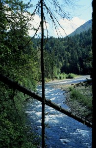
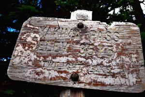
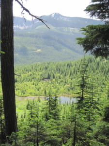
As I was finishing Hiking Washington’s History, I learned about the Lime Kiln Trail, a relatively new trail that follows portions of the old Everett and Monte Cristo Railway grade. The Old Robe Canyon hike in the book follows the South Fork Stillaguamish River on the north bank as the river flows west.  The Lime Kiln Trail starts south of the river and joins it after a mile and a half, going east along the south bank of the river to the concrete remains of a bridge that once crossed the river.   Engineers warned early on that the force of the river would wash out man-made structures.

Yes, there is a lime kiln on this trail–quite impressive on site.

Lime kiln on the Lime Kiln Trail
Lime kiln

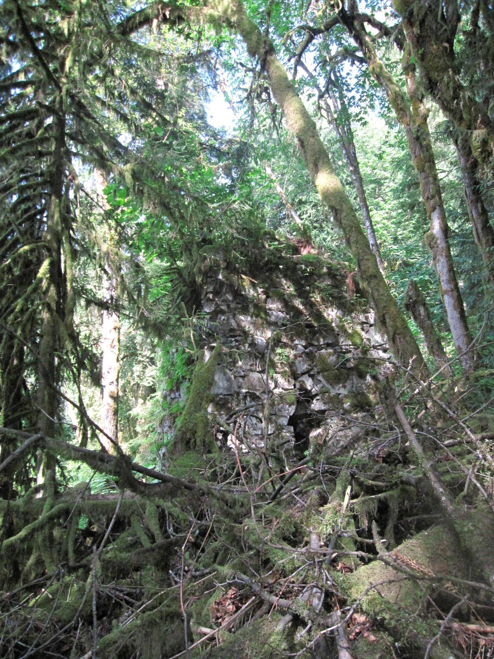
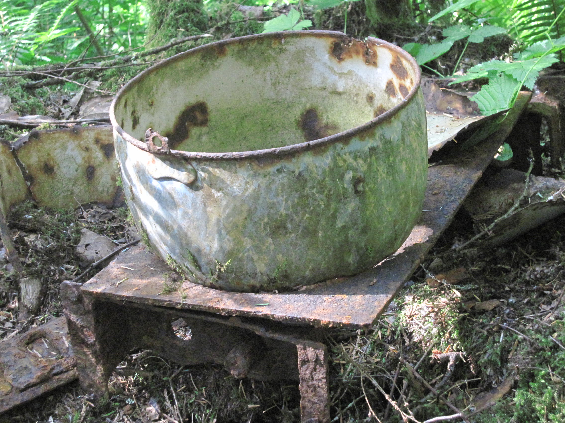
During the 1800s, the kiln converted limestone into lime (calcium oxide) to make mortar and plaster for construction, including parts of the Everett & Monte Cristo Railway. Limestone from a nearby quarry was carried to the top of the kiln by small cable cars and burned in the kiln to change the rock to powder. Interpretive panels at the trailhead give the history of the railway and the lime kiln.  Artifacts along the way (pieces of rotary saw blades, bricks, a bucket) tell a visual story.

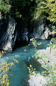
This is a 3.5 mile trail, one-way, fairly level (600 some feet of elevation gain, gained in several places) and hikable year-round. (In mid-May 2016 the salmonberries were already ripe.)  The first part follows a logging road through regrowing clear cuts but then reaches the old railroad grade and canyon.

Directions: Take State Route 92 east to Granite Falls. In town, turn right on South Granite Avenue. In three blocks, go left on Pioneer Street, which becomes Menzel Lake Road. In a few miles, go left on Waite Mill Road to the signed trailhead on the left.

IMG_0562


Bellingham History Walk

As I researched and wrote Walking Washington’s History: Ten Cities, I knew that local historians would know much more about their cities.  I relied on their written work, talked and walked with many of them, visited local libraries and historical societies and hoped for the best.  As Dean Kahn of The Bellingham Herald wrote with insight, “summarizing local history goes quickly while researchers’ work clarifying and correcting history is a much slower process.”  An error can easily become part of the historical record, repeated without further research by historians and writers down the line.

IMG_2839Such an error is the source of the bricks that built the Richards and Company Building in Bellingham.  These aren’t ordinary bricks but the longest lasting bricks in a building in the state.  Constructed in 1858, the warehouse and store catered to several thousand miners who were camped in Bellingham waiting for construction of a trail to the Fraser River gold rush.  I wrote that the bricks were “shipped as ballast in ships from Philadelphia around Cape Horn through San Francisco.”  Search the Internet and you will find this “fact” stated many places:  the Legacy Washington project on the Secretary of State’s page, in HistoryLink, on the City of Bellingham website, and on the Whatcom County Historical Society website.  I’m in good company here.

The permanence of this very brick, however, has provided time for more research.  A study of the bricks made during a Save Our History project discovered that the bricks were manufactured in San Francisco and shipped to Bellingham on the bark Ann Parry.  The evidence?  In the spring of 2012 the bricks were matched to a fragment of Nagel brick, made by a brick maker of that name in San Francisco.  A good description of this discovery  is on the website of the Whatcom County Historical Society.

One piece of history has been clarified by good research, and the updating begins.


historic murals

Main Street Moments

In writing Walking Washington’s History: Ten Cities, I chose a moment of significance for each city.  See Main Street Moments, a photo essay on the University of Washington Press Blog.

Each city had at least one moment when it was significant in the history of Washington Territory or the state.

Vancouver started as a fur-trading post in 1825, commanding a vast empire from Alaska to California.

Olympia, at the Washington end of the Oregon Trail, became the territorial capital in 1854 and fought off rival cities until statehood in 1889.

Walla Walla boomed on mining rushes to claim the title as largest city in the territory in the 1860s and a rival to Olympia for the capital.

Tacoma won the terminus of the Northern Pacific Railroad and boomed for two decades in the 1880s and 1890s.

Seattle boomed as a jumping off point for the gold rush in the Yukon.

Everett’s corporate titans and labor unions clashed in the early 1900s.

BellinghamBellingham’s four-towns city emerged from logging, mining, railroads, canneries and a university.

Yakima marketed the riches of the Yakima Valley.

Spokane reclaimed downtown and the river running through it with Expo ’74.

Bellevue changed from a suburb to an edge city.

Elwha River

Elwha River

Goblin Gates on the Elwha River, named by Charles Barnes of the Press Expedition

When the Press Expedition men hauled their gear up the Elwha River in the winter of 1889 and 1890, the river was wild.  When I hiked it and wrote about it more than 100 years later, the river was dammed and contained, the Altaire campground was good for a pre-hike wiener roast, and the Whiskey Bend trailhead was an easy drive.  No more.  The river has been un-dammed and unleashed to choose its own path, which has included flooding the road to the trailhead and the Altaire campground.  You may now have more sympathy for the six men, four dogs, and two mules who spent two and a half months just getting to Whiskey Bend from Port Angeles.  (This hike is described in Hiking Washington’s History.) 

Linda Mapes describes “A river gone wild” and its effects on hikers in The Seattle Times, March 13, 2016.

Yakima Pass

HIkers on a Pacific Northwest Historians Guild hike in July, 2016

Yakima Pass has become one of my favorite historical hikes.  The first part is delightful–to Cottonwood Lake and Mirror Lake and then south on the Pacific Crest Trail to Yakima Pass.  It is rich in Native American and railroad exploration history, narrated by George McClellan’s journals.

In late July, on a sunny day, you’ll find bear grass, columbine, glacier lily, trillium, lupine, blue skies, and sparkling lakes. Frogs claim rocks in the creek that cascades down from Mirror Lake. Mirror LakeEven as trees grow again in the clearcut areas, the lay of the land and the pass visible from the lakes remain the same.  You’ll know you’ve reached the pass by the feel of the land and the weathered sign that marks it.

If you don’t want to climb back up to Mirror Lake, on the PCT, there is a short-cut back to Road 5480 (and your parked car) on two gullied old logging roads, which are easy enough to follow, but be forewarned that the footing can be tricky–rocky, slippery and overgrown.  When I first used this loop I could catch a glimpse of my car from this route, but now vegetation has grown obscuring that view–but not the lovely view of Lost Lake.

Lila Becker points to the Mirror Lake trailhead.

The hike has not changed greatly since I recounted it in Hiking Washington’s History, but here are a few clarifications: when driving to the trailhead, at the unmarked four-way intersection, veer right along the north side of Lost Lake (don’t take the sharp right). The last half-mile up to the trailhead is completely un-drivable, and parking spots on Road 5480 can be competitive on the weekend.  Although a sign points uphill to the Mirror Lake trailhead, the beginning of the trail itself is not marked by a sign but by a cairn or row of rocks, thoughtfully placed.YP sign


Twilight Lake at Yakima Pass

Coal Mines Trail


IMG_2648My Tuesday Trekkers group hiked the Coal Mines Trail in June 2014.  Since I wrote Hiking Washington’s History, the trail has become much more shaded by the growth of trees and brush on both sides.  Mining sites are harder to identify in the first two-thirds of the trail, but heaping  slag piles still rise above mine sites and Crystal Creek flows coolly along the walk.  Roslyn’s coal mining history is not forgotten by residents but seems less prominent.  The Northwest Improvement Company store building will reopen soon with new businesses.  The spire of the Catholic church soars above the town on the hillside, and the Roslyn cemeteries grow, including a memorial for Tom Cravens, native son who died fighting the Thirty-Mile Fire.


Columbia Hills Homesteads


As spring approaches, hikes in the Columbia Hills are some of my favorites. Spring and fall are the best times for these hikes as summer temperatures can be extreme, and the hills are exposed to the winds in the winter.

In October 2012 I led a Friends of the Gorge-sponsored hike to the Columbia Hills Homesteads. We hiked down Eight-mile Creek on the east side to see the Lucas homesteads and then came back to the Crawford homestead on Dalles Mountain Road. We saw deer, four wild turkeys, two apples trees in fruit, and a Concord grape vine, planted by the Lucases, still producing sweet grapes. The newer discoveries to me were the Henry and William Brune homesteads and timber cultures. These claims are largely west of the road to Stacker Butte. With help from local historian and hike leader Jim Denton, and with some hiking partners willing to ramble, we found the Skibbe gravesite, root cellar foundations, water troughs, the restored Brune cabin, and stone alignments.

Trails are planned for this undeveloped state park, but for now it’s a great place to ramble and find history. An interpretive panel has been installed at the Crawford complex. A Discover Pass is required for parking.

On a May 2013 hike for Friends of the Gorge, our group discovered the yellow rose bush planted by Mary Lucas in front of her homestead in the 1890’s. This Harrison’s Yellow was likely brought as a cutting from the east and has continued to grow wild here, surviving long past the house John Crawford built for his bride.

columbiahills_sm1


Duwamish RIver Trail

Carrosino 1
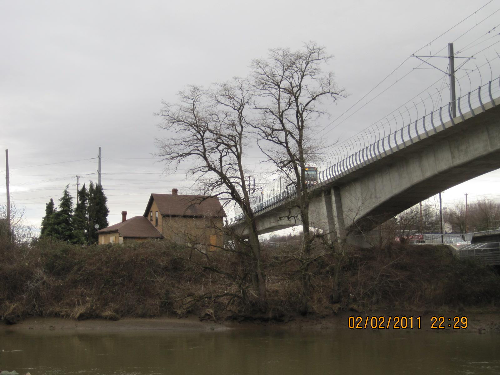
In late August 2015 I was biking along the Duwamish/Green River Trail and noticed earth-pushers at work across the river where the Carosino farmhouse used to be.  The Carosinos were among the Italian truck farmers who first settled along the Duwamish in the late 1800s and eventually raised corn, pumpkins, radishes, and other vegetables to sell at the Pike Place Market.  The farmhouse had stood along the path of Sound Transit light rail but survived that construction.  Where had it gone?

My query to the city of Tukwila, which had bought the property, brought the somewhat reassuring response that the site is being developed as an off-channel salmon habitat project called Duwamish Gardens.  At this point in their journey down the Duwamish, fish are transitioning from fresh water to salt water.  This channel will give them a place to feed and rest, not a bad use for a former vegetable farm.

Black Lives and the Law in Washington Territory

“Black Lives and the Law in Washington Territory” tells the story of a boy who was a slave in Olympia in the 1850s.  Free Boy, A True Story of Master and Slave recounts the relationship between James Tilton, Surveyor-General of the territory, and Charles Mitchell, a boy owned by his cousin in Maryland.  The boy’s mother had died in a cholera epidemic, and Tilton’s cousin thought she was sending the boy to a free territory–except that it wasn’t.

This talk looks at the doctrine of partus in colonial law affecting the status of children born to slave women;the Missouri Compromise of 1820, the Compromise of 1850, the Kansas-Nebraska Act of 1854,and the Dred Scott decision of 1857, all relating to the status of slavery in territories; and finally the ruling by a Victoria judge that made Mitchell “a free boy.”

Tilton protested to the governor of Washington Territory and then to the U.S. Secretary of State, without success, that the freeing of the boy from the steamer Eliza Anderson, where he had stowed away, was a breach of international law.  Six months later, the United States moved beyond compromise and the rule of law to civil war.  Mitchell was a free boy years before the war would determine the fate of others held in bondage.

The Chinese at Coal Creek

History is never finished and done, in the past.  The writing of history brings new revelations about the history that may not yet have been told, that has been intentionally neglected, usually the more shameful events from the past.  When I wrote about the Coal Creek Trail in Hiking Washington’s History, I knew there were Chinese miners at this site in a Seattle suburb, but I did not know the full story.

R. Gregory Nokes writes about the burning of the homes of 49 Chinese miners near the Coal Creek mines in 1885 in his book Massacred for Gold.  The book also recounts the killing of more than 30 Chinese gold miners on the Oregon side of Hells Canyon in 1887.  The source of the information about Coal Creek is a Statement of Claims prepared by Chang Yen Hoon, the head of the Chinese legation in Washington, D.C.  Chang sought compensation for various acts of violence against Chinese immigrants in the U.S., including losses of $4,054.88 from the Coal Creek Mine in Washington Territory.

That wasn’t the first such incident at Newcastle.  In 1876, 40 Chinese mine workers were driven from the same mines, according to a coal miner who wrote to his wife:  “The miners at the Seattle mine [at Newcastle] drove all the Chinamen away from there Saturday last” (quoted in Historylink.org Essay 219).

The name China Creek lingers in contemporary Bellevue near the site of the Newcastle mines.  It is most often associated with a trail, a housing development, and the Golf Club at Newcastle, with no mention of the source of the name.  Ironically, the golf course at Newcastle has recently been purchased by a Chinese company.