Walking Washington’s Riverfronts

Sacajawea Heritage Trail along the Columbia River in Richland

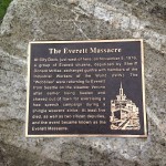
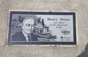
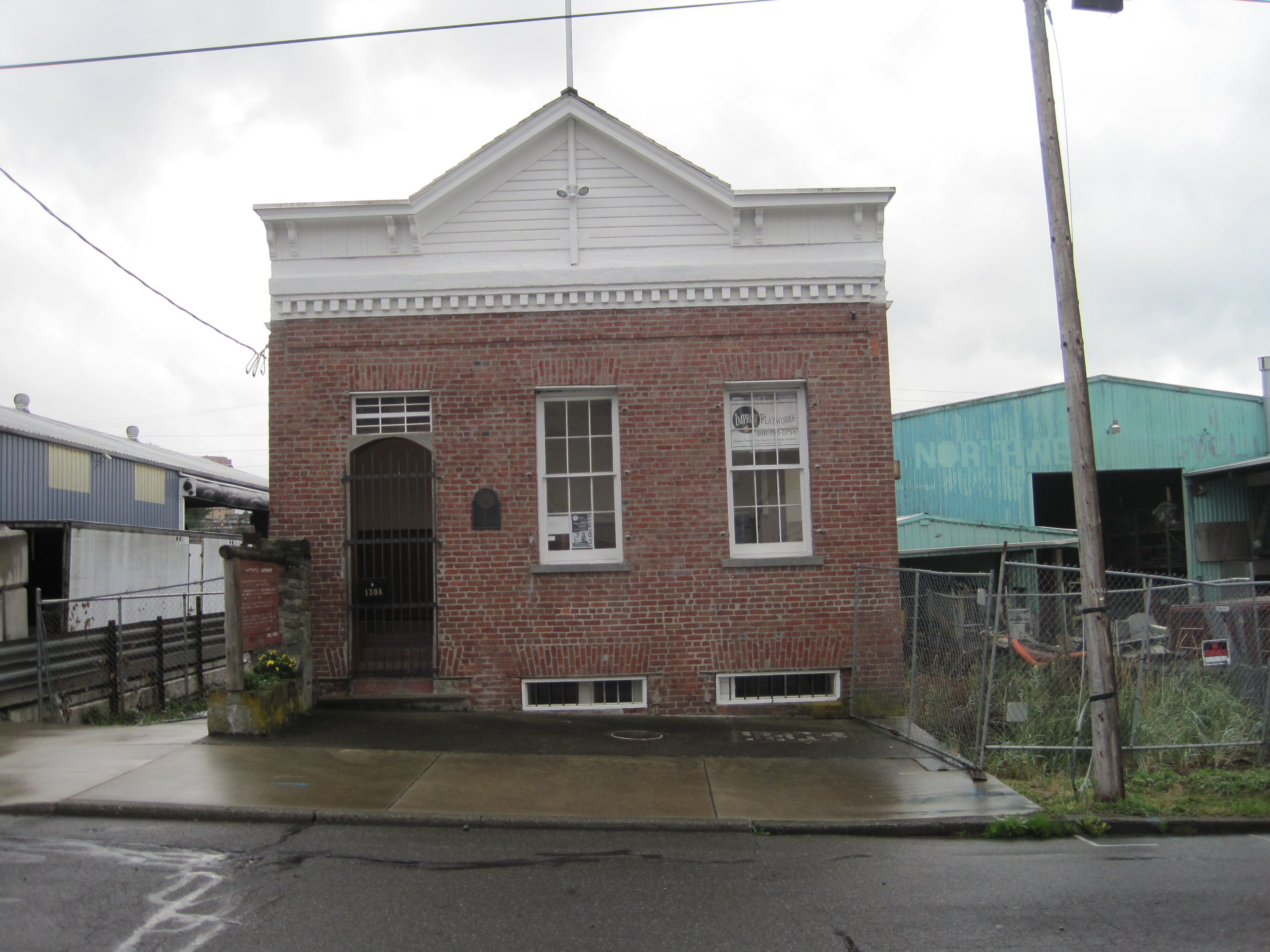
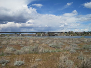
While writing Walking Washington’s History: Ten Cities, I was struck by the importance of rivers to the development of cities in Washington–the Puyallup in Tacoma, the Duwamish in Seattle, the Yakima and Naches rivers for Yakima, the Columbia for Vancouver and the Tri-Cities, the Snohomish for Everett, the Spokane for Spokane.  When most of these cities were founded, in the late 1800s, rivers were the transport of choice for people and freight.

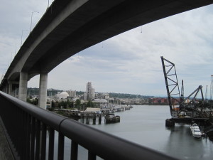
Over the decades, many of those rivers have been dredged, straightened, drained of their power, and polluted.  Although it is now an industrial powerhouse, the lower five miles of the Duwamish River is also a SuperFund site,requiring millions of dollars of clean-up to restore it to even a semblance of its original health.

The West Seattle bridge soars over the mouth of the Duwamish River.

The flow and falls of the Spokane River had been so drained for use as a power source and its islands covered with railroad structures that some residents hardly knew it existed. The mouth of the Puyallup River in Tacoma was renowned not for the smell of a tideflat at low tide but for the aroma of pulp.

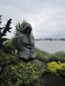
Gradually attitudes toward the rivers in our midst have changed.  We have reclaimed them as common space.  When Spokane hosted a world’s fair in 1974, the citizens reclaimed the riverfront.  With cooperative efforts, the city pulled up railroad tracks, restored much of the river’s flow, and cleaned up pollution.  The result is a riverfront of trails and community gathering spots at the city’s historical center.

Ilchee, of the Chinook Nation, gazes out over the Columbia River.

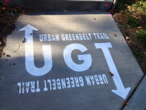
Although still in the process of a massive cleanup, Seattle has a Duwamish River bike trail that goes for miles into the Puget Sound lowlands.  Tacoma’s riverfront walk skirts the Thea Foss Waterway, carved from the river and tideflats.  Vancouver’s Columbia River Renaissance Trail winds through the early maritime explorations and trade of the lower Columbia River.  The Yakima Greenway follows the Naches and Yakima rivers as they converge on the edge of Yakima.

These walks and more are described in an article I wrote for Northwest Prime Time’s June 2018 issue.  Read it here. 


Everett Massacre Revisited

After my talk in Everett yesterday, I revisited the site of the Everett Massacre, a confrontation on the waterfront that led to at least seven deaths one hundred years ago.  When I wrote Walking Washington’s History: Ten Cities, there was nothing marking the site on Port Gardner Bay, but an audience member told me there was now a plaque.   Sure enough a plaque sits at the western foot of Hewitt Ave. where a brick spur ends at the railroad tracks.  This isn’t the exact spot where shots rang out on the City Dock, November 5, 1916, but it’s close.  The plaque is grounded on granite that should Plaque remembering the Everett Massacreoutlast the shifting sands of both the waterfront and historical interpretation.

My eye was drawn beyond the rock to a more temporary and more moving memorial–eleven cedar IMG_3379wreaths, red ribbons intertwined, hung on a fence, each with the name of a man killed or missing in the worst labor-management conflict in Washington history. Members of the Industrial Workers of the World (the I.W.W. or Wobblies) had been beaten and chased back to Seattle when they tried to support a shingle-weavers strike in the IMG_3367mills.  They returned by boat and were met at the dock by the sheriff and a force of deputized men.  A shot rang out, and in the ensuing battle, at least five Wobblies died, as well as two deputized citizens.  Another six or seven Wobblies went missing, never reclaiming the union cards they had left in Seattle that morning. They may have drowned after being shot or jumped into the water to escape the firing.  Another 50 were wounded.

IMG_3370Each wreath bears the name of a “fellow worker” who died that day.  They were hung by contemporary members of the I.W.W. who then completed the march the Wobblies had intended in 1916, to the Speakers Corner at Hewitt and Wetmore.  The wreaths hang on a fence with a No Trespassing sign, still drawing lines between corporate interests and public access.

The Everett Herald published a detailed discussion of the clash near its 100th anniversary.

My walking tour of Everett in Walking Washington’s History ends at the site of the massacre.  For more historic walking tours of Everett, visit www.historiceverett.org


Coal Creek to Redtown Trail

See my article on this hike, “Find a Trail to History,” in the October 2017 issue of Northwest Prime Time.

The Coal Creek trail to Redtown, site of industrial mining in the late 1800s, was the first hike I did in Washington and the inspiration for Hiking Washington’s History.  I could walk out of my suburban home, follow a social trail down a hill, then a deer trail through wet land to Coal Creek. Coal Creek Trail The trail followed the creek, past an old farm-site (with apple trees), past mining artifacts (wagon wheels chained to a tree, chunks of coal), onto the old road-bed of the Seattle and Walla Walla Railroad, past a cinder mine and the remains of the railroad turn-table, and finally reached Redtown.  Near the end of the hike there were old interpretive signs and a black hole in the ground–an air shaft going down 100 feet to the mines.  Coal CreekThe trail was rich in both natural and human history.

In the 30 years since my first hike King County has greatly improved the trail, part of the Cougar Mountain Regional Wildland Park.  Updated, easy to read interpretive signs mark the Redtown end of the trail.  Bridges and stairs have been constructed.  The Primrose loop has been restored.

The most important charms remain–the concrete blocks of the turntable covered with fall leaves, the North Fork falls full in October, the remains of a wood-constructed plume in the creek and the visible coal seam, even the bricks discarded from the Mutual Materials lot, now a housing development.  You can still walk this three-mile trail, out of sight of homes or parkways, and be greeted by this weathered sign, an historic artifact on its own.  Coal Creek sign

Richland Urban Greenbelt walk

Attending the Washington State Trails Coalition Conference last weekend, I enjoyed a history walk through Richland’s urban greenbelt led by Nancy Doran.  The narrated walk embodied what I call a virtual trail, a walk on sidewalks, trails, even through parking lots when a detour was necessary–all connected by a story, the story of Richland’s World War II history.  My literary acquaintance with Richland comes through Paul Loeb’s Nuclear Culture and Kathleen Flenniken’s volume of poetry, Plume. This on the ground walk brought more social history into the picture.

Richland was a small farming town with only 247 residents when the United States government plucked it and the nearby towns of Hanford and White Bluffs off the map as the perfect place to produce plutonium for the atomic bomb.  Farms, homes, and some businesses were forced out in 1943 and housing for 11,000 workers was quickly built.  Richland became a bedroom community.  We walked past the alphabet homes–built on floorplans A, B, D, E,F or G–with the goal of having high and low income earners living side by side.  We saw the site of the women’s dormitories, which anticipated the housing needs of single women workers.  We saw the few buildings that preceded the 1940s, the current high school with the Bombers mascot, and a lovely walkway along Hip Deep Creek to the riverfront trail.  The Sacajawea Heritage Trail goes for miles along the Columbia River, connecting the Tri-Cities. Sacajawea Heritage Trail

Much of the architecture along the way reflected the technology and mid-century modern tone of the city.  The thoughtful planning of G. Albin Pehrson left parkland as a buffer between homes and businesses, land through which the paved urban trail goes today. For those without a guide, the trail is marked in the sidewalk but volunteer-led history tours are periodically offered through Richland’s Parks and Recreation Department.

A brochure by Gary Fetterolf, “Walking Tour of World War II Era Alphabet Homes,” describes the alphabet homes and the origin of street names, named after army engineers.  It is available at the new Richland Urban Greenbelt TrailHanford Reach Museum, a concrete structure rising out of the windswept ground, which broadens the story to the river and the land around it.


History Lives in Renton

Renton is the 9th largest city in Washington, with a population of more than 100,000.  Yet it has been overshadowed by neighboring Seattle and Bellevue, which rank 1st and 5th, and by its association with industry and jobs–coal mining, clay works, Boeing and PACCAR.  Even though it has a 405 and Rainier Avenue, the main routes of travel, bypass the main street at a fast clip.

During its centennial in 2001, the city marked a walking tour with markers designed by Doug Kyes with text by Barbara Nilson. Renton Number one is land where the Duwamish had lived for hundreds of years, at the confluence of the Cedar and Black rivers.  The Cedar River still runs through the middle of the city, but only a remnant of the Black River remains after the lowering of Lake Washington in 1916.

The community of Renton began when seams of coal were discovered near streams in 1873.  A lumberman, Captain William Renton, financed the Renton Coal Company, which opened a mine on the north side of Renton Hill.  He was also a trustee of the Seattle and Walla Walla Railroad which transported the coal.  Renton depotThe town incorporated in 1901.  Located at the south end of Lake Washington along the railroad and a road to Seattle, Renton became a place where Seattle workers lived.

Renton’s moment of historical significance in Washington, its period of largest growth, was during World War II.  The Seattle Railroad Car and Manufacturing Company, which became PACCAR, had moved to Renton in 1907 and produced 30 Sherman tanks a month during the war.  The Boeing Airplane Company located a major factory on the north side of Renton and began turning out B-29s at the peak rate of six a day.  Thousands of workers flocked to the city seeking work, and the War Department helped build multi-family units.  In the decades after the war, Renton became the “Jet Capital of the World.”

The latest new neighbors are the Seattle Seahawks, with a training facility on Lake Washington.  Like many cities along Puget Sound, Renton must deal with contaminated properties on its waterfront, particularly the Port Quendall properties where creosote and coal tar were manufactured.  The city has enhanced enjoyment of the Cedar River with a walking and biking trail and the city library built over it.

To discover the real downtown of Renton, Renton ghost signfollow the “History Lives Here” walking tour, available online or by brochure at the Renton History Museum, 235 Mill Ave. South.

And does anyone know if there is any historical significance to this mural painted on a building in downtown Renton?

Renton mural

Bellingham History Walk

As I researched and wrote Walking Washington’s History: Ten Cities, I knew that local historians would know much more about their cities.  I relied on their written work, talked and walked with many of them, visited local libraries and historical societies and hoped for the best.  As Dean Kahn of The Bellingham Herald wrote with insight, “summarizing local history goes quickly while researchers’ work clarifying and correcting history is a much slower process.”  An error can easily become part of the historical record, repeated without further research by historians and writers down the line.

IMG_2839Such an error is the source of the bricks that built the Richards and Company Building in Bellingham.  These aren’t ordinary bricks but the longest lasting bricks in a building in the state.  Constructed in 1858, the warehouse and store catered to several thousand miners who were camped in Bellingham waiting for construction of a trail to the Fraser River gold rush.  I wrote that the bricks were “shipped as ballast in ships from Philadelphia around Cape Horn through San Francisco.”  Search the Internet and you will find this “fact” stated many places:  the Legacy Washington project on the Secretary of State’s page, in HistoryLink, on the City of Bellingham website, and on the Whatcom County Historical Society website.  I’m in good company here.

The permanence of this very brick, however, has provided time for more research.  A study of the bricks made during a Save Our History project discovered that the bricks were manufactured in San Francisco and shipped to Bellingham on the bark Ann Parry.  The evidence?  In the spring of 2012 the bricks were matched to a fragment of Nagel brick, made by a brick maker of that name in San Francisco.  A good description of this discovery  is on the website of the Whatcom County Historical Society.

One piece of history has been clarified by good research, and the updating begins.